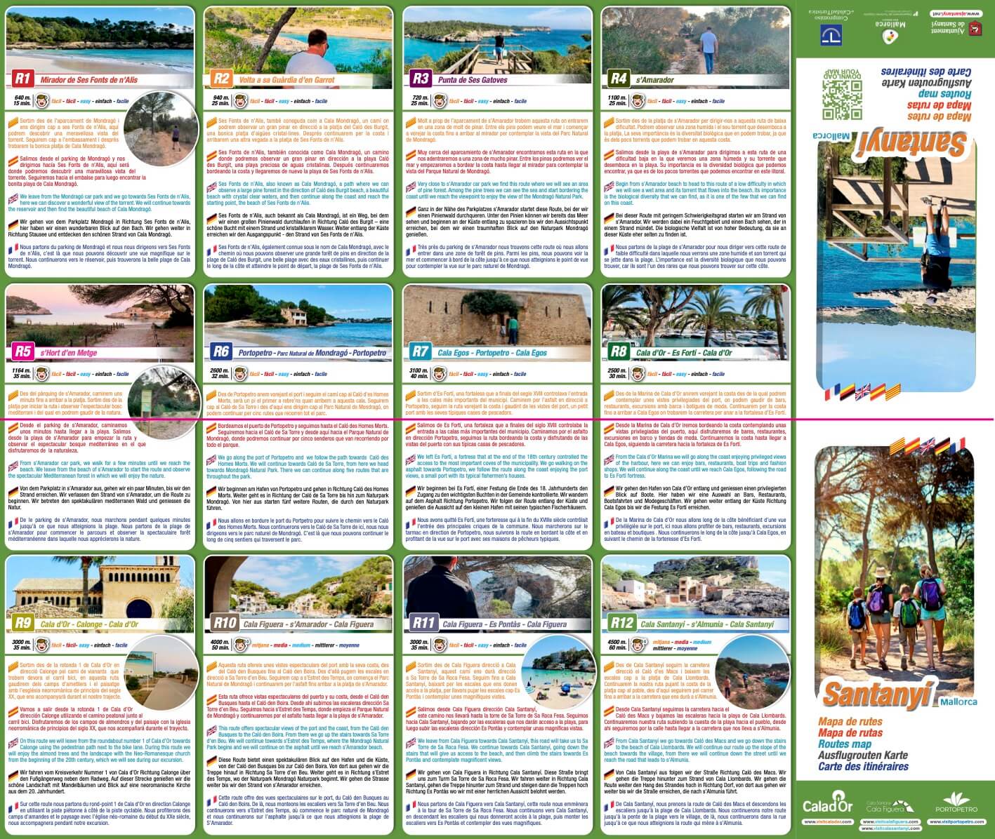
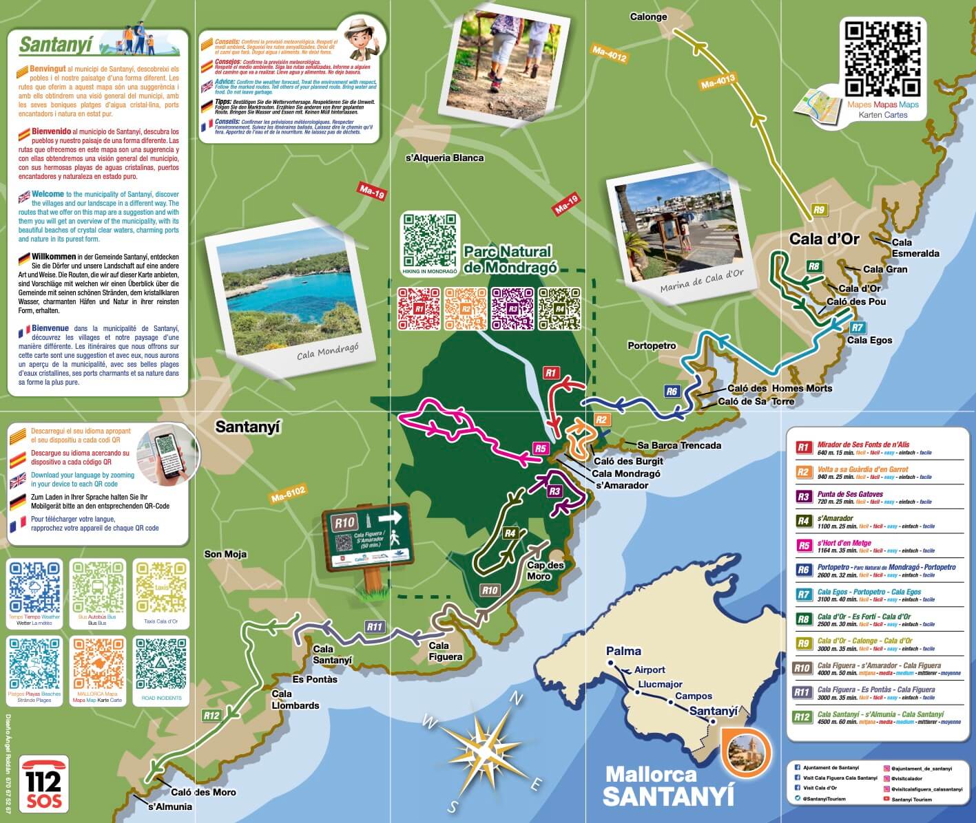
A total of twelve hiking routes in Santanyí have been added to the municipality’s tourist offer. These routes allow visitors to enjoy Santanyí both in summer and winter. The new routes begin and end in different parts of the municipality and are mainly distributed along the coastal area.
Classified according to their difficulty, although most of them are accessible to everyone, these hiking routes in Santanyí have been compiled on a map. It shows the route in detail, as well as a QR code that offers the necessary information to follow the route. It also offers other complementary information of interest to hikers. To signpost the routes, different indicators and signs have been distributed along the route of each one, which include the QR codes with the aforementioned information.
New hiking routes in Santanyí
The routes range in length from 650 metres to 4.5 kilometres. For this reason, almost all of them can be completed in less than an hour. The routes pass through places such as the Mondragó Natural Park to visit the viewpoint of Sus Fuentes de Alis. Or they run from towns such as Cala d’Or, Cala Figuera, Cala Santanyí or Portopetro, passing through Calonge, s’Almunia or es Pontàs.
- Mirador de Ses Fonts de n’Alis.
- Volta a sa Guardia d’en Garrot.
- Punta de ses Gatoves.
- S’Amarador.
- S’Hort d’en Metge.
- Portopetro – Parque Natural de Mondragó – Portopetro.
- Cala Egos – Portopetro – Cala Egos.
- Cala d’Or – Es Fortí – Cala d’Or.
- Cala d’Or – Calonge – Cala d’Or.
- Cala Figuera – s’Amarador – Cala Figuera.
- Cala Figuera – Es Pontàs – Cala Figuera.
- Cala Santanyí – s’Almunia – Cala Santanyí.
The mayoress of Santanyí, Maria Pons, assures that “the creation of these routes helps to extend the tourist season beyond the summer season. All efforts are too little to help our business fabric”.


Leave A Comment