
The Serra de Tramuntana is set to benefit from a new tool designed to promote and showcase its cultural heritage. The Consell de Mallorca and the University of the Balearic Islands (UIB) have presented Georoutes, a project that has enabled the digitalisation of 21 cultural itineraries and nearly 200 geolocated heritage sites with the aim of making them more accessible to both residents and visitors.
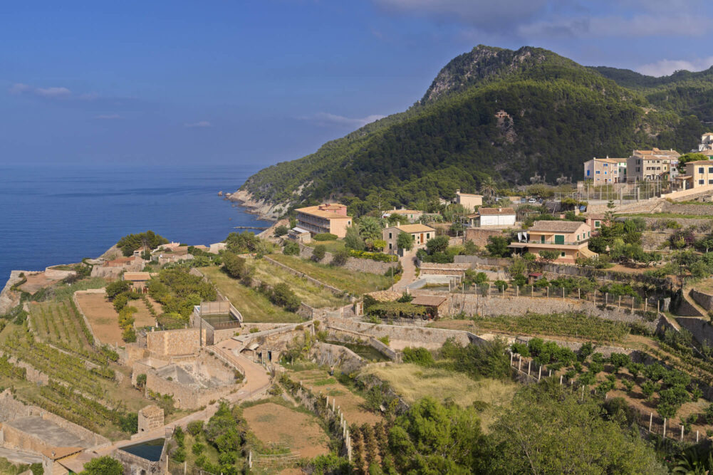
Banyalbufar, at the end of the Camí des Correu route. Photo: Serra de Tramuntana Consortium
The initiative forms part of the Tourism Sustainability Plan for Destinations and has received an investment of €382,671 from the Next Generation EU programme. The project has been implemented by the University-Business Foundation of the Balearic Islands (FUEIB) and developed by the RiscBal-UIB team in collaboration with the Department of Tourism and the Serra de Tramuntana Consortium.
Georoutes helps to highlight the historical, ethnological, architectural and landscape heritage of the Serra through a network of itineraries designed to be explored on foot or by bicycle across the fourteen municipalities that make up this UNESCO World Heritage Site.
More than 1,000 routes analysed
The technical team began by carrying out an analysis of more than 1,000 routes in order to select the 21 itineraries ultimately included in the project. In addition, 196 geolocated heritage records have been created, providing historical, geographical and technical information on the main points of interest along each route.
According to Joan Estrany, director of RiscBal and technical coordinator of the project, the initiative has made it possible to collect and organise information from more than a thousand sources, transforming it into an open digital infrastructure that can be reused for research, public outreach and heritage management.
Interactive mapping and GPX downloads
The resources developed include specialised cartography, interactive maps and a digital platform featuring advanced navigation and visualisation tools. The system will allow users to consult topographical profiles, access three-dimensional visualisations and download routes in GPX format thanks to its integration with platforms such as SITMUN and Wikiloc.
The project also includes informational materials in Catalan, Spanish, English and German to help promote the itineraries among residents and visitors.




Leave A Comment