 One of the best-known views of the bay of Palma is that of the Bellver castle (1310), a permanent watchtower over the city, which crowns the promontory, with a broad, gentle slope speckled with pines and scrubland, and whose lower strip, the one closest to the sea, is urbanised by the El Terreno neighbourhood.
Thanks to the preservation of the altarpiece of Saint George, the work of Pere Nisard (1470), we can still see today what this area looked like in the Middle Ages, since on one side of the main scene in the painting, the hillside appears when there was still no construction, except perhaps the Torre d’en Carròs, at the height of what is now S’Aigo Dolça. On the other hand, a path can be seen which, from the gates of the city walls, runs parallel to the coast until it reaches the port of Portopí. This road must have been very busy since Palma was founded by the Romans around the first half of the 1st century BC, and this was due to the nature of the Palma coastline. Until the 20th century, on days when the wind was strong, the only safe refuge for ships was the port of Portopí, so land communication between the port and the city was always constant.
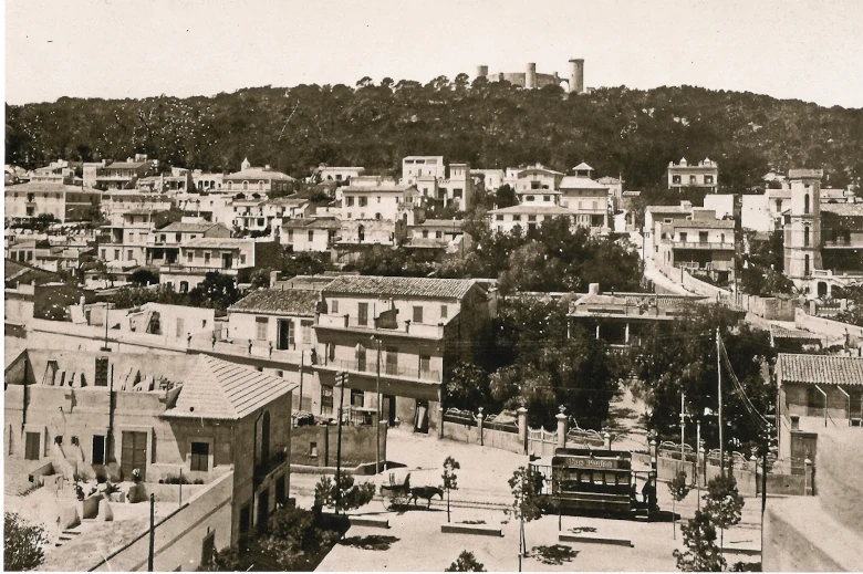
Bellver Castle overlooks the El Terreno neighbourhood, which housed the second homes of the Mallorcan bourgeoisie. Photos: FAM-Fotos Antiguas de Mallorca.
Due to the fact that the entire foothills of Bellver castle depended directly on the king’s estate, as well as the insecurity of the coast – exposed to pirate attacks – this area remained undeveloped for centuries. The aforementioned defence tower, d’en Carròs – sold in the 15th century – and the urgent need, forced by the plague, to build a lazaretto in 1656 – Sa Quarentena – were an exception.
Arrival of the 18th century
It was with the arrival of the 18th century, its enlightened ideas and new mentalities that people began to look for places for recreation near the sea, and it is in this new conception of recreation and rest that the origins of the El Terreno neighbourhood can be found.
One of the first grants given by the king to a private individual took place in 1769, when the canon of the Cathedral, Mossen Jaime Oliver, requested a plot of land from the Royal Patrimony – hence the origin of the place name – between La Caleta and the mouth of the Mal Pas stream, with the idea of building a house in a healthy place, close to the sea, for recreation and rest. Thus arose the rafal of El Terreno, which years later would give its name to the whole neighbourhood.
In 1807, this farmhouse became the property of Cardinal Antonio Despuig and around 1850 it passed to the Rubert family, which is how it came to be known as Can Rubert. Juan and Andrés Rubert were the ones who began to divide up the estate and sell plots of land. The house that Canon Oliver had built still stands today and is the headquarters of the Nazareth Foundation.
A few years after the cession of El Terreno, in 1777, the king again granted another concession of his lands, in this case to the Court painter Cristóbal Vilella. This artist belonged to the small group of Mallorcans who had trained at the Royal Academy of San Fernando in Madrid. His estate bordered on one side with the rafal of El Terreno, and on the other with the lazaretto of Sa Quarentena. Here he built a house so that he could draw all kinds of animals on behalf of the Natural Sciences Cabinet in Madrid. Today this area of the neighbourhood is known as Son Catlaret.
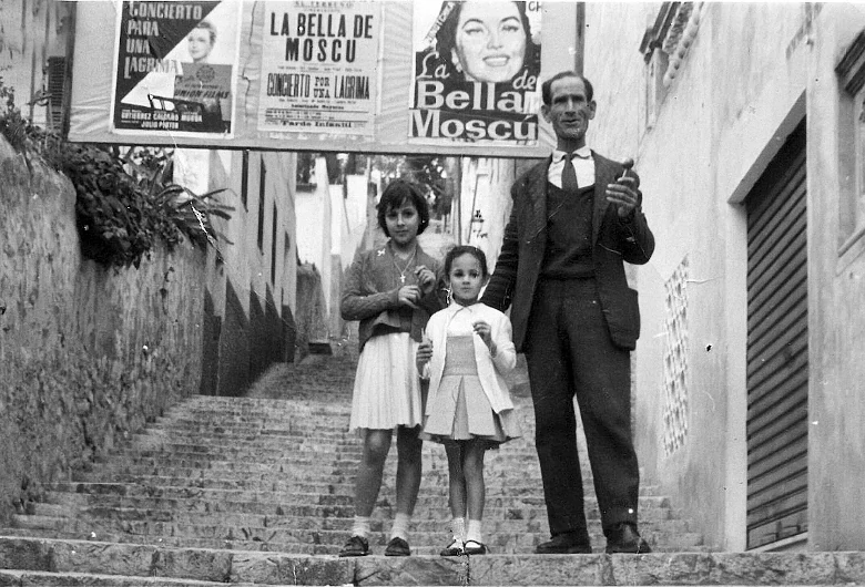
Staircase next to the Sala Regina, back in the late 1950s.
Another recreational house built in the 18th century was S’Aigo Dolça. The house that was built there was very simple, but its subsequent division into plots was important for the urban development of the neighbourhood. The subdivision into hamlets during the 18th century was only a preamble to what was to be developed much more intensively during the 19th century, especially from the second half of the 19th century onwards. It was at this time that the streets were laid out and the new plots of land in the neighbourhood were articulated, extending along the raised side of the old Portopí road, now Carrer de Joan Miró, and rising up towards Bellver Castle. Thus, in 1803, the surgeon Gabriel Sabater asked the Royal Heritage to build some huts so that he could bathe in the sea. Today, Can Sabater would be located in the Hotel Victoria.
The epidemic of 1821
In 1821, a yellow fever epidemic considerably decimated the population of Palma. Some of its inhabitants, fleeing from a possible contagion inside the city, sought refuge on the lower slopes of Bellver castle, leading to the appearance of a provisional settlement built with wooden huts. Its construction was possible thanks to the felling of the surrounding pine trees, which meant razing most of the Bellver forest to the ground, which, a few years later, would facilitate the subdivision of the area.
In 1869, José Villalonga-Lloeta, another important promoter of the subdivisions in the neighbourhood, gave a plot of land so that the church of the Virgen de la Salud could be built. By 1887, the neighbourhood was fully consolidated with more than three hundred houses. At the beginning of the 20th century, El Terreno became a refuge for quite a few European and American foreigners, and since then it has been considered one of the most cosmopolitan neighbourhoods in Palma.
Photo gallery
-
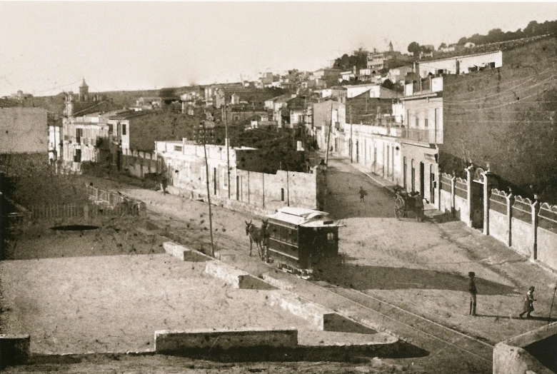
- Plaza Gomila, in the days when the mule tram used to run.
-
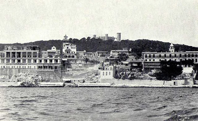
- Area of the Hotel Victoria and the Bellver Baths, before the creation of the Paseo Marítimo.
-
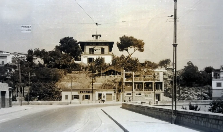
- The well-remembered Hotel California, which housed the area’s pharmacy on the ground floor.
-
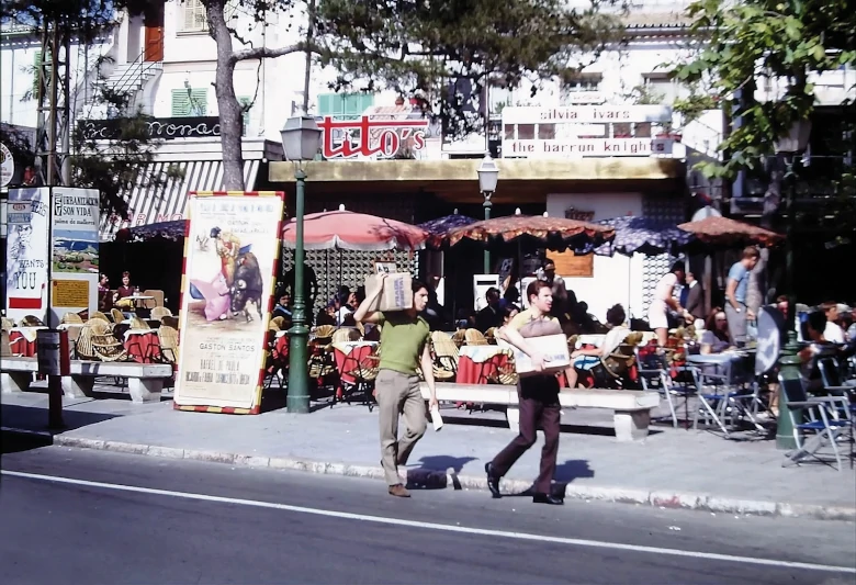
- Great atmosphere in the Plaza Gomila in 1969.


Leave A Comment